About Countries
Test your knowledge of world geography by identifying countries from their unique shapes, borders, and geographical features as seen from satellite imagery. Learn to recognize nations from a bird's eye view and develop a deeper understanding of global geography.
This mode features countries from all continents, including both easily recognizable nations with distinctive shapes and challenging landlocked countries.
Why Learn Countries from Satellite View?
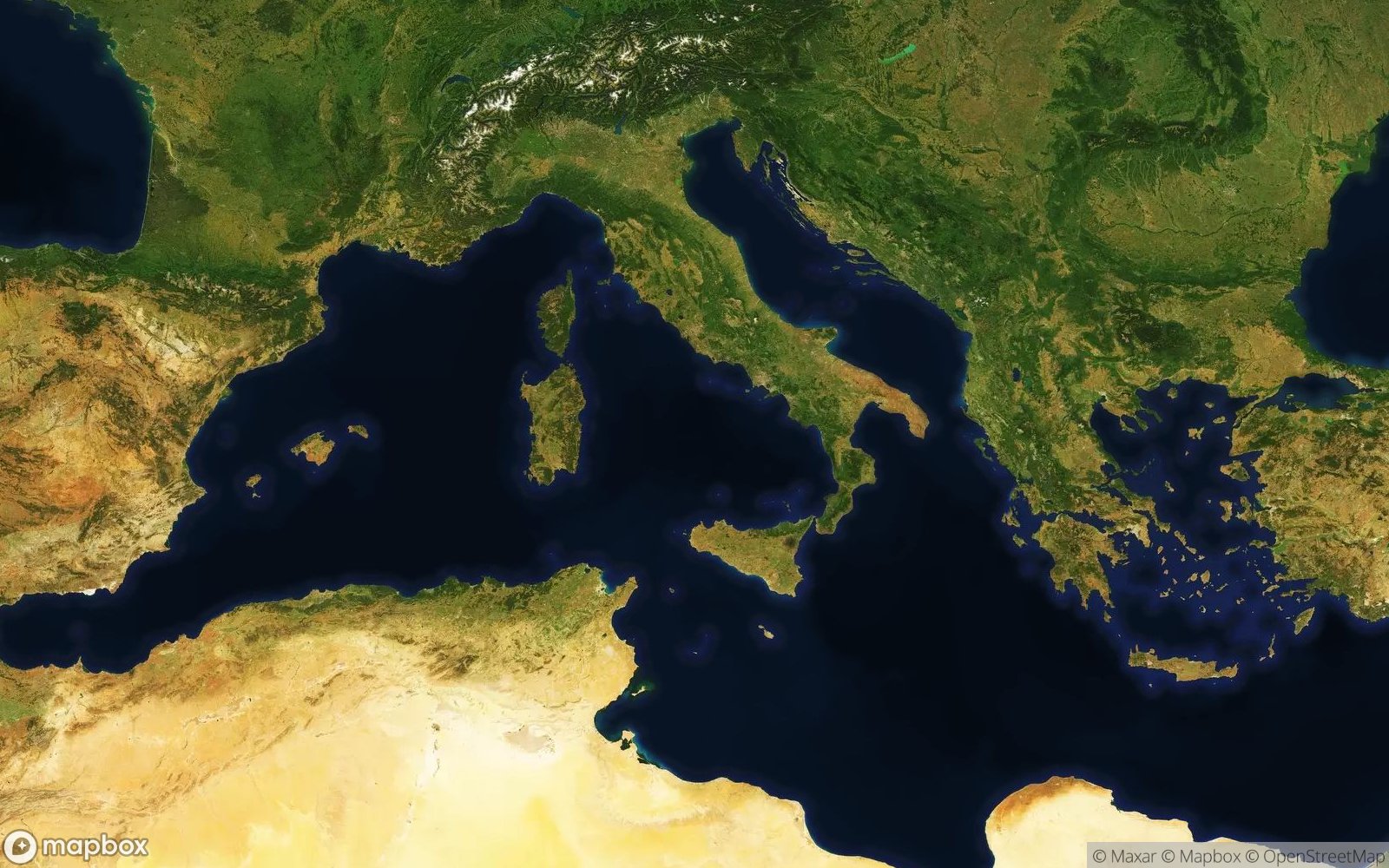
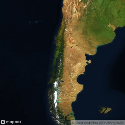
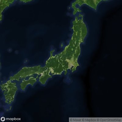
Understanding countries from satellite perspective builds foundational geographic literacy and spatial awareness. Each nation's shape tells stories of geology, history, and borders formed by nature or politics. Italy's distinctive boot kicking Sicily, Chile's impossibly long Pacific coastline, or Japan's island arc curving along tectonic boundaries—these shapes encode geographic knowledge fundamental to understanding our world.
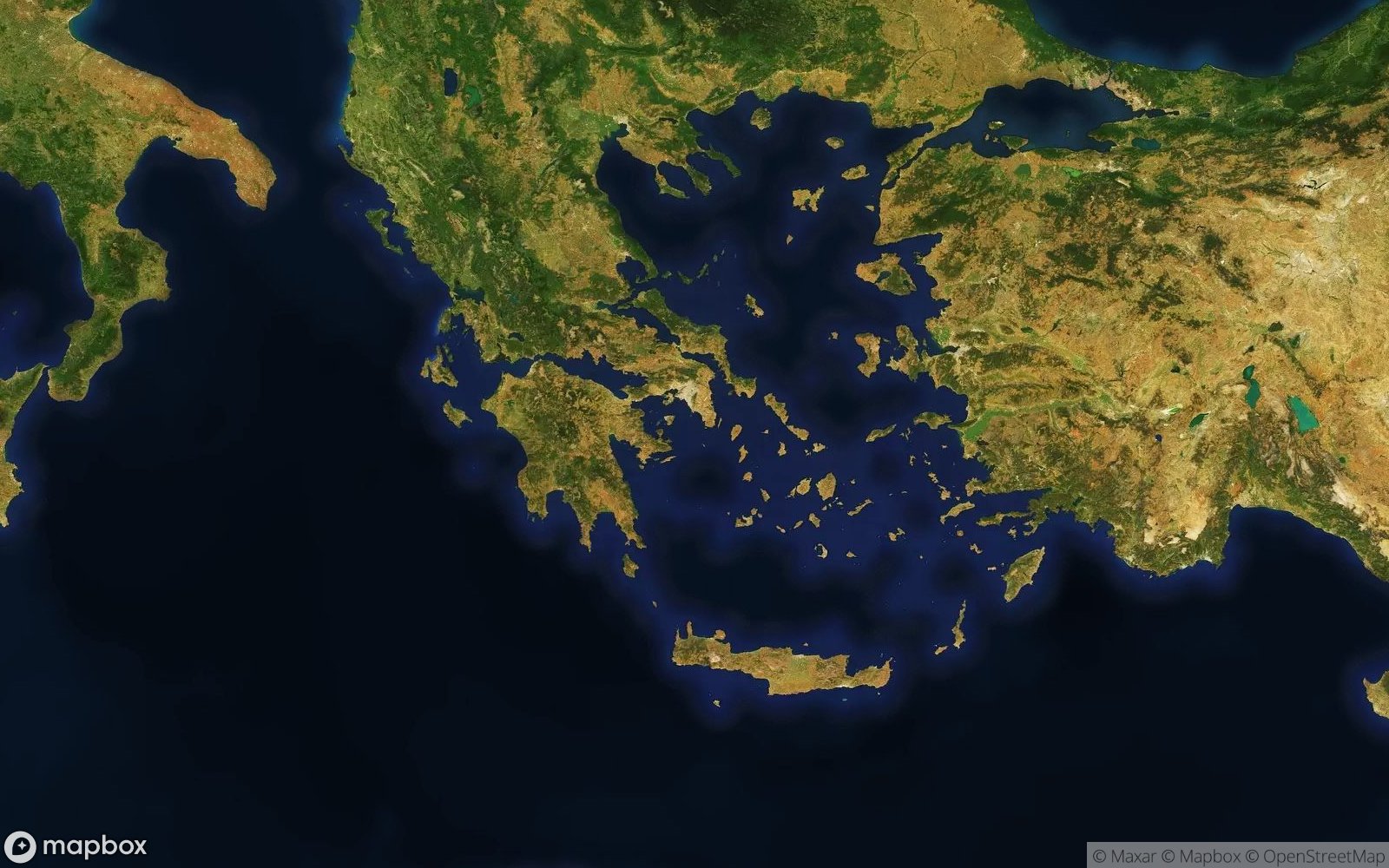
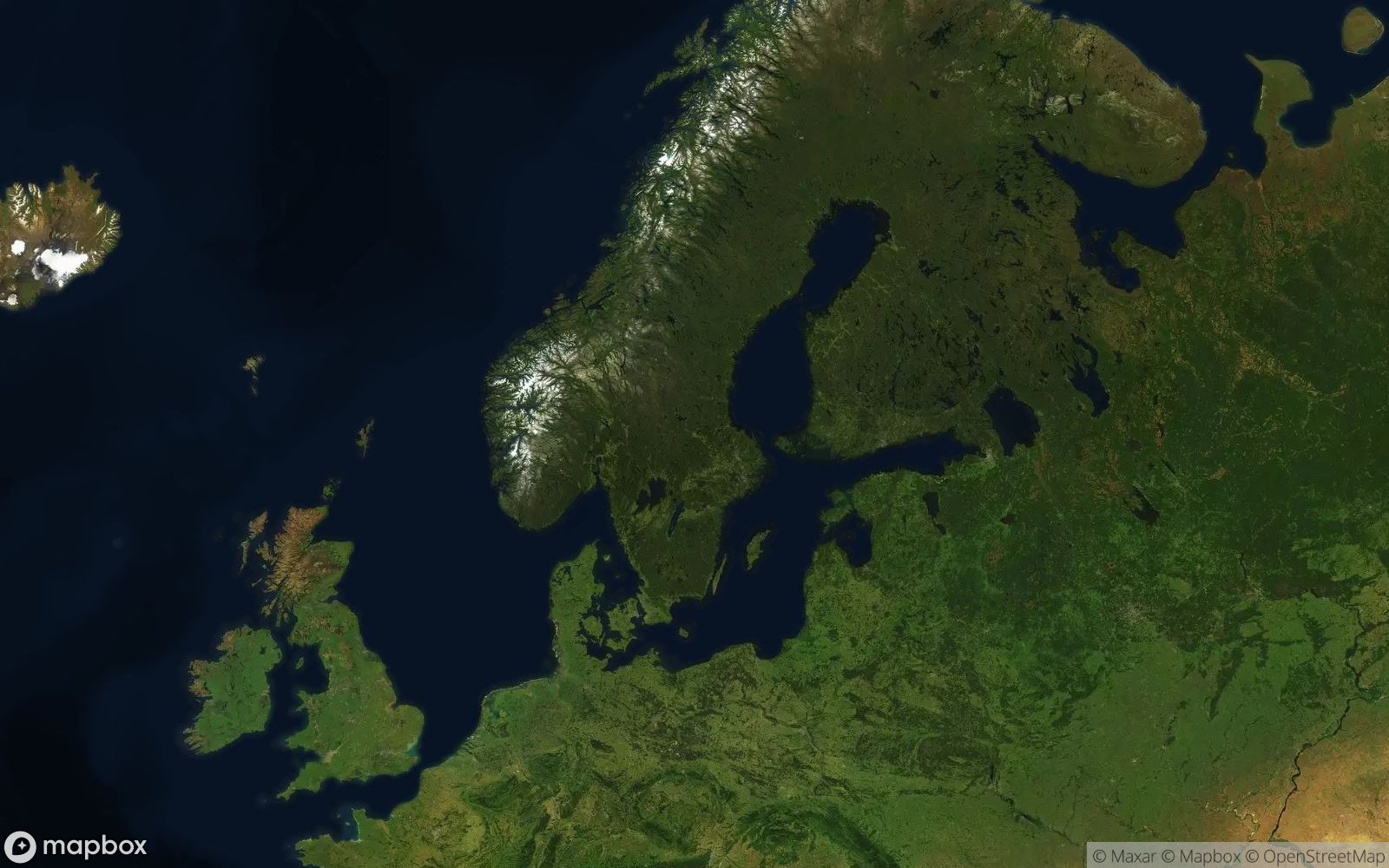
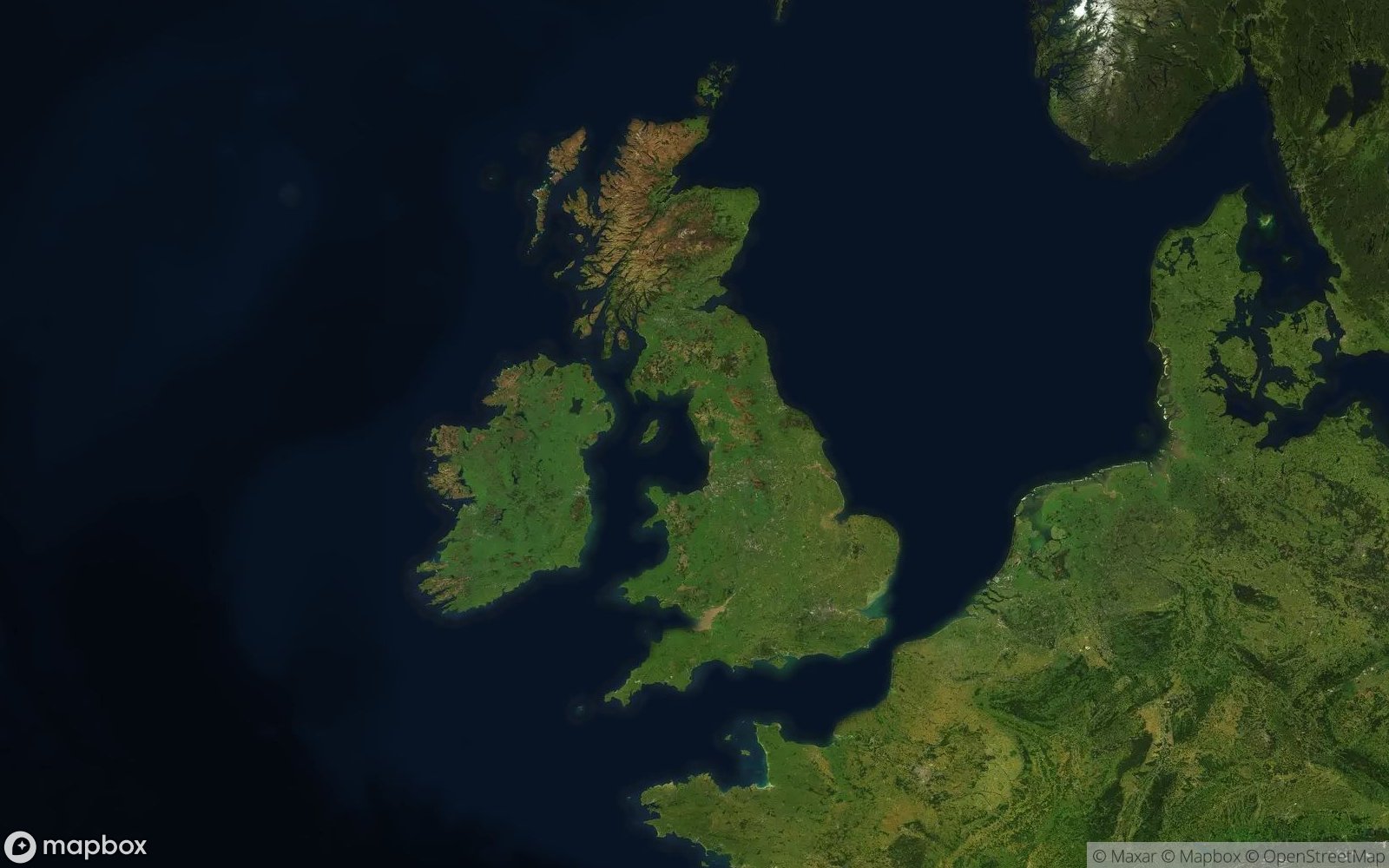
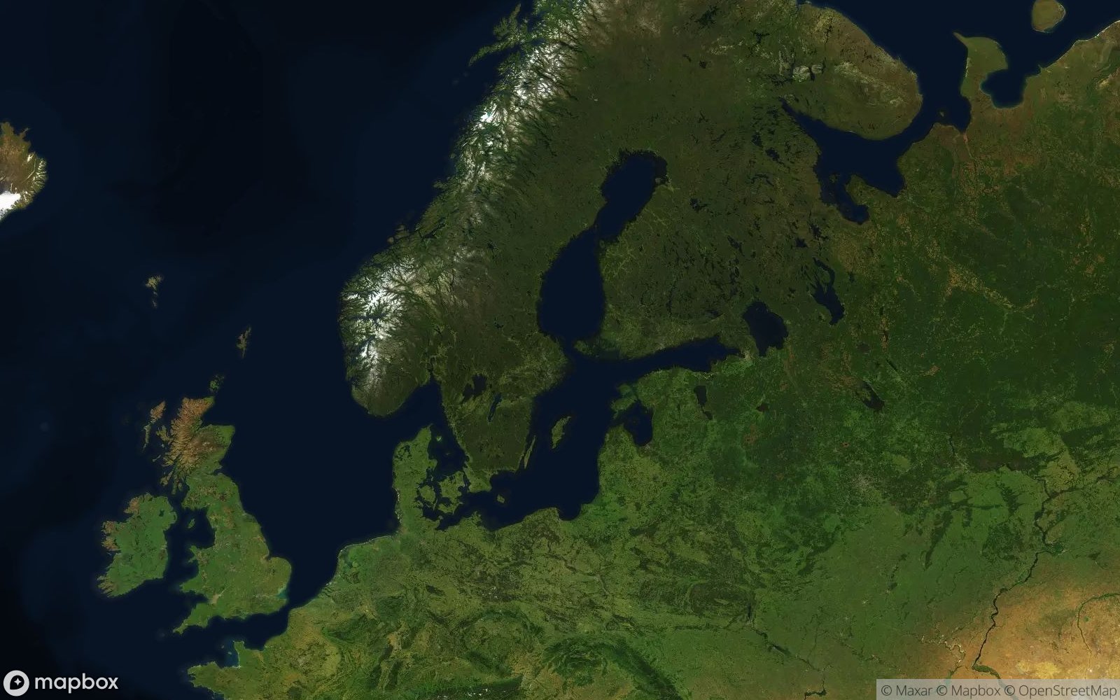
Learning country recognition enhances comprehension of physical geography and climate zones. You'll see how mountain ranges like the Himalayas or Andes define borders and weather patterns, how great rivers like the Amazon or Nile sustain civilizations, or how deserts like the Sahara dominate national territories. Coastline complexity reveals histories: Norway's fjords carved by glaciers contrast with Namibia's smooth Atlantic shore, while Greece's fractured coastline reflects its island-rich geography.
This skill connects to geopolitics, economics, and demographic patterns. Large nations like Russia, Canada, or Australia show vast empty interiors where climate limits settlement, while dense coastal development marks Japan or the Netherlands. Border shapes reflect colonial history (straight African borders) versus natural features (rivers forming European boundaries). Whether studying current events, planning travel, or satisfying curiosity, country recognition provides geographic context for understanding global affairs.
What You'll Discover
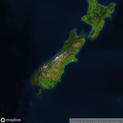
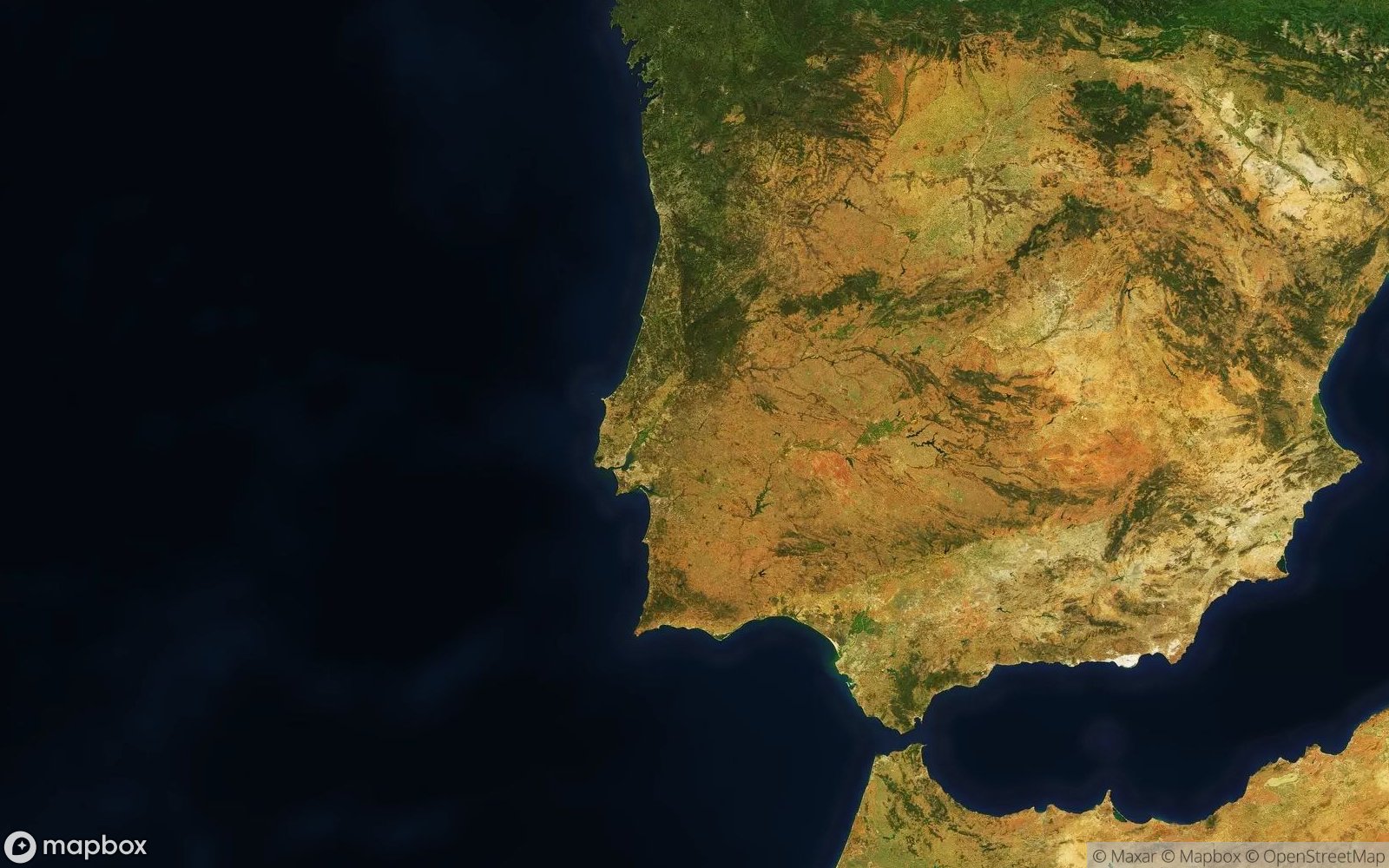
Satellite views reveal distinctive national characteristics. Island nations show unique profiles: Madagascar's huge outline off Africa, New Zealand's two-island configuration, or Philippines' archipelago of thousands of islands. Peninsula nations display characteristic shapes: Italy's boot, Greece's complex mainland with scattered islands, or Florida's projection (though a state, not country). Long thin nations like Chile hugging the Andes or Vietnam following Southeast Asian coastlines create unmistakable silhouettes.
Physical geography becomes evident: the Nile greening Egypt's desert, the Amazon's massive drainage across Brazil, or mountain ranges casting rain shadows visible as vegetation changes. Coastline variations tell climate stories: icy Norwegian fjords, warm Caribbean beaches, or temperate Australian shores. You'll recognize how geography constrains or enables development—coastal cities versus isolated interior regions.
Border patterns reveal history: straight lines in Africa and Middle East reflect colonial mapmaking, while European borders following rivers and mountains show natural boundaries. Some nations display unique features: the Netherlands' extensive land reclamation visible as geometric polders, visible deforestation along Brazil's agricultural frontier, or distinctive infrastructure patterns reflecting development levels.
Featured Countries
...and many more!
Tips for Identifying Countries
- Look for distinctive shapes: Italy's boot, Chile's narrow strip, or Japan's archipelago
- Compare sizes: Large nations like Russia or Brazil vs. smaller European countries
- Study coastlines: Complex (Greece, Norway) vs. smooth (Namibia, Peru)
- Spot island nations: Unique shapes like Madagascar, Sri Lanka, or New Zealand
- Check for major rivers: The Nile, Amazon, or Great Lakes help identify regions
- Observe mountain ranges: The Andes, Himalayas, or Alps are visible from space
- Notice terrain patterns: Deserts, forests, and other features reveal identity
Ready to Test Your Geography Knowledge?
Can you identify all the countries?
Play Countries Quiz