About Forbidden City
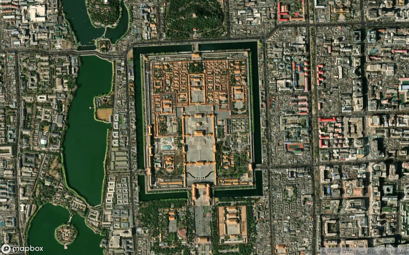
The Forbidden City is a palace complex in Dongcheng District, Beijing, China, at the center of the Imperial City of Beijing. It is surrounded by numerous opulent imperial gardens and temples including the 22-hectare (54-acre) Zhongshan Park, the sacrificial Imperial Ancestral Temple, the 69-hectare (171-acre) Beihai Park, and the 23-hectare (57-acre) Jingshan Park.
The Forbidden City was the former Chinese imperial palace from the Ming dynasty to the end of the Qing dynasty (the years 1420 to 1912). It now houses the Palace Museum. The Forbidden City served as the home of emperors and their households and was the ceremonial and political center of the Chinese government for almost 500 years. The complex consists of 980 buildings and covers 72 hectares (180 acres).
Constructed from 1406 to 1420, the complex exemplifies traditional Chinese palatial architecture and has influenced cultural and architectural developments in East Asia and elsewhere. The Forbidden City was declared a World Heritage Site in 1987 and is listed by UNESCO as the largest collection of preserved ancient wooden structures in the world.
Play Landmarks Quiz 📖 Read More 🗺️ Google Maps 📘 Landmarks Guide