💡 Pro Tip: Look for the "Blue Ring". If you see a vivid turquoise circle with deep blue in the middle or outside, you are looking at shallow coral reefs. This almost guaranteed means the Tropics.
1. The Structure Test
Islands are formed in violent or biological ways. The shape tells the story.
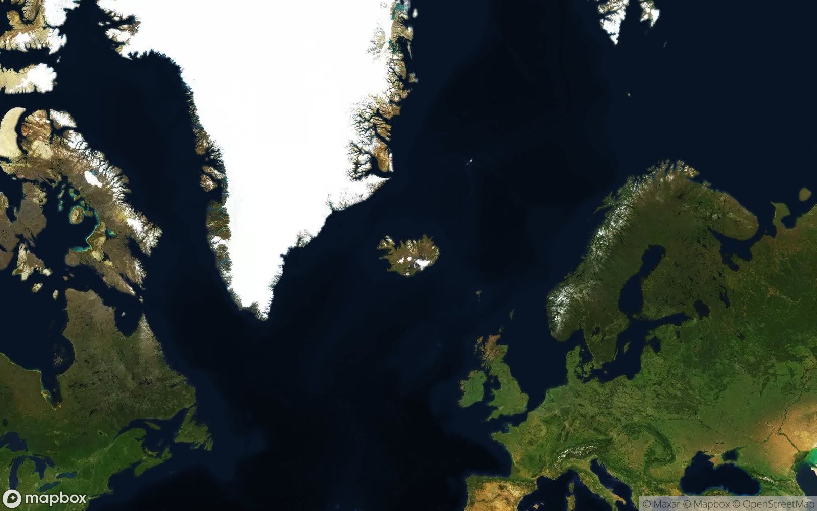
Rise steeply from the sea. Look for a central peak (often with clouds stuck to it) and radial
ridges flowing down like spokes.
Likely: Hawaii, Canaries, Iceland.
Flat and low. A ring of thin land/reef surrounding a central lagoon. No mountains.
Likely:
Maldives, French Polynesia, Pacific Ocean.
2. Natural vs. Man-Made
Sometimes the geometry is too perfect to be natural.
Fractal, chaotic coastlines. Random blobs. This is nature.
Straight lines, perfect palm shapes, or world map replicas. This is engineering.
Likely:
Dubai (Palm Jumeirah), Bahrain, China (airports).
3. Detective Strategy: Vegetation Color
If there is land, what color is it? This tells you the latitude.
-
🌴
Deep Green: Tropical Rainforest. Near the Equator. (Bali, Fiji, Caribbean).
-
🏜️
Dry Brown/Red: Arid climates. (Canary Islands, Galapagos, Greek Islands in summer).
-
❄️
White/Grey: Polar or Tundra. (Greenland, Svalbard, Antarctica).
4. Volcanic vs Coral Atoll Distinction
Island formation type is identifiable through shape, elevation, and surrounding water colors.
Circular or elongated shapes with visible central peak(s). Dark rocky coastlines, steep terrain visible as texture. Lush vegetation at lower elevations (green). Examples: Hawaii Big Island, Reunion, Iceland.
Perfect rings or crescents enclosing turquoise lagoons. Very low elevation (barely above sea level). White sand beaches, palm tree patterns. Examples: Maldives, Kiribati, Tuvalu.
5. Barrier vs Continental Islands
Geologic origin affects island shape and position relative to mainland.
-
🏖️
Barrier Islands: Long, thin sand spits parallel to coastlines. Examples: Outer Banks (North Carolina), Fire Island. Very low, often showing sand dunes as wavy patterns.
-
🏝️
Continental Islands: Separated from mainland by shallow water (visible as lighter blue). Share geology with nearby coast. Examples: Great Britain, Madagascar, Tasmania. Show varied terrain like nearby mainland.
6. Archipelago Pattern Recognition
Island chains reveal tectonic and volcanic histories.
🏘️ Archipelago Clues: Linear chains (Hawaiian Islands) follow volcanic hotspot tracks—youngest at one end, oldest/most eroded at the other. Arc-shaped chains (Caribbean, Indonesia) mark subduction zones where tectonic plates meet. Scattered random islands suggest continental shelf flooding (Maldives) or glacial history (Finland's coast).