💡 Pro Tip: Don't try to find specific landmarks first. Look at the "skeleton" of the city (streets and blocks) to determine which continent you are likely looking at.
1. The Grid Layout (North America)
The easiest pattern to spot. Streets run North-South and East-West at perfect right angles, creating square or rectangular city blocks.
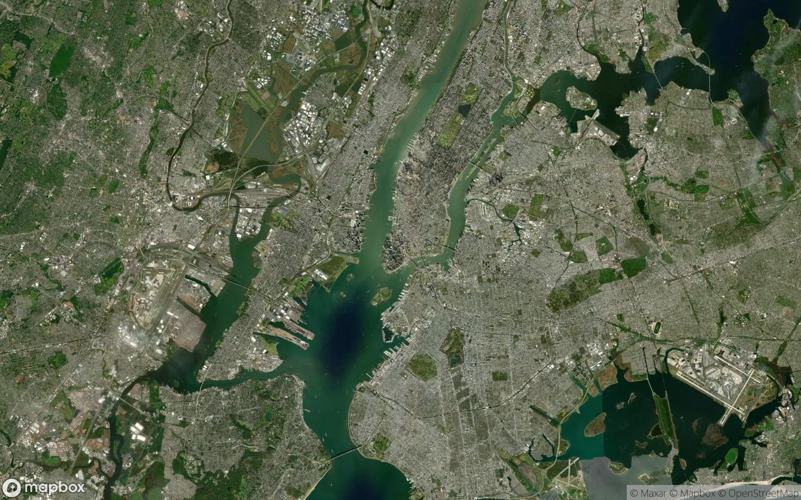
Looks like graph paper or a chessboard. Very organized and repetitive.
USA (New York, Chicago, Phoenix), Canada (Toronto), and some newer Latin American cities. Explore our Cities category to practice identifying grid patterns.
2. The Radial "Spiderweb" (Europe)
Common in historic European capitals. A dense central core (often the old town) with major avenues radiating outward like spokes on a wheel.
Chaotic center, ring roads circling it, and straight avenues cutting through like a starburst.
Paris (the classic example), Moscow, Milan, Madrid, Brussels. These cities are featured in Cities Quiz Mode.
3. The Organic Maze (Old World & Asia)
No clear geometry. Streets wind and curve, following the terrain or centuries of unplanned growth. It looks like veins in a leaf or a cracked desert floor.
Tightly packed buildings, narrow winding streets, no long straight lines.
North African medinas (Fes, Cairo), historic Asian centers, medieval Italian towns.
4. Detective Strategy: Roof Colors
If the layout isn't clear, check the color of the rooftops. This is a powerful "Elimination Strategy" tool.
-
🔴
Terra Cotta / Red: Southern Europe (Spain, Italy, Croatia, Southern France).
-
⚪
White / Flat: Hot climates. North Africa, Middle East, Greece, Southern Spain.
-
⚫
Grey / Dark Slate: Northern Europe (UK, Germany, Scandinavia, Paris).
-
🌈
Bright / Varied: Caribbean, Latin America, Southeast Asia.
5. Port Cities vs Inland Cities
Port cities have distinctive features visible from space that set them apart from landlocked urban areas.
Look for: Cargo terminals with geometric rectangles (shipping containers), long piers jutting into water, cranes visible as tiny dots, and industrial zones near the waterfront. Examples: Rotterdam, Singapore, Los Angeles.
No water access (unless a river port). Look for: Major highway intersections forming the city core, rail yards,and airport prominence. Examples: Denver, Madrid, Johannesburg.
6. Capital Cities vs Industrial Cities
Capital cities often have distinct layouts reflecting their governmental role.
-
🏛️
Capital City Traits: Large green spaces (parks, government complexes), wide ceremonial boulevards, symmetrical planning, massive monuments visible from space (e.g., Washington DC's National Mall, Brasília's planned layout).
-
🏭
Industrial City Traits: Factories with large roofs, dense rail networks, warehouses, smokestacks (visible as shadows), less green space, more sprawl. Examples: Detroit, Essen (Germany), Shenzhen.
7. Advanced Strategy: Grid Direction
Not all grids are aligned North-South! This is a powerful clue.
🧭 Rotation Analysis:
Aligned with Compass: Most American grid cities (Chicago, New York) align streets with cardinal directions for surveying convenience.
Rotated Grids: Coastal cities often rotate their grid to follow the shoreline. San Francisco's grid tilts to match the peninsula. Melbourne's grid aligns with the Yarra River. If the grid is askew, look for water or terrain features forcing the rotation.