About Charles de Gaulle
Paris Charles de Gaulle Airport, also known as Roissy Airport, is the largest international airport in France and the second busiest airport in Europe. Opened in 1974, it is located in Roissy-en-France, 23 km (14 mi) northeast of Paris. It serves as the principal hub for Air France and a destination for other legacy carriers.
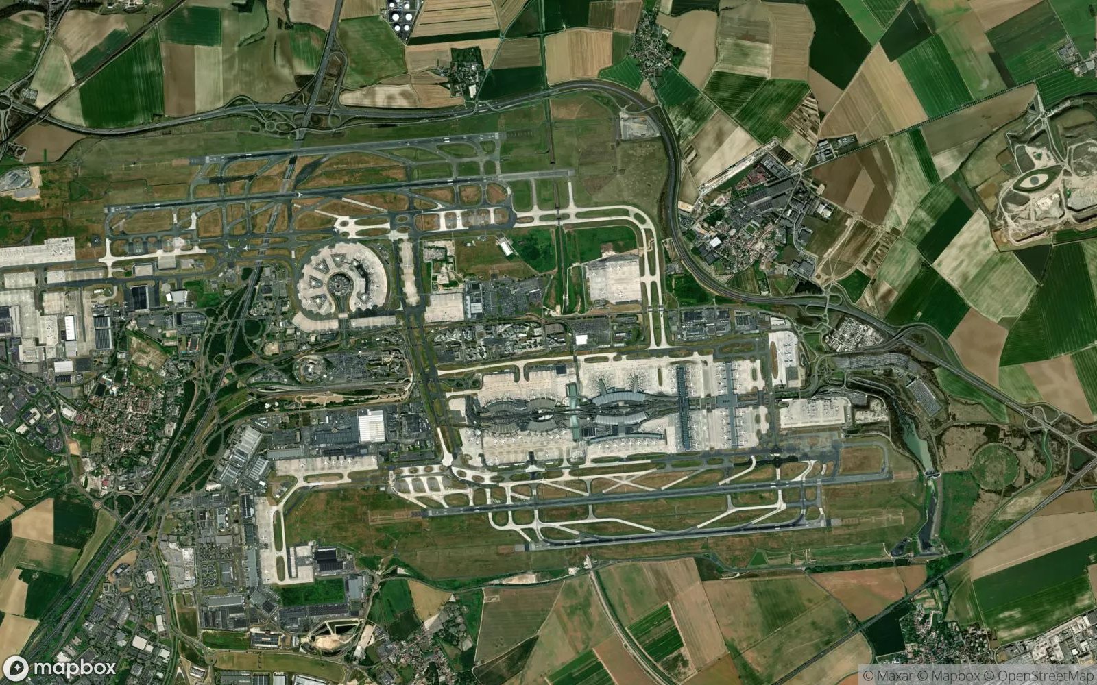
The airport is known for its unique and futuristic architecture, particularly Terminal 1, designed by Paul Andreu in the shape of an octopus. Passengers access the satellites via underground tunnels with crisscrossing escalators in the central atrium. Terminal 2 is a massive complex of seven sub-terminals built along a central spine road.
CDG has four parallel runways, allowing for efficient traffic management. It also houses a TGV high-speed train station, directly connecting air passengers to the French rail network and cities like Lyon, Marseille, and Brussels. While criticized for its complex layout, it remains a vital economic engine for the Paris region.
Play Airports Quiz 📖 Read More 🗺️ Google Maps 📘 Airports Guide