About Autódromo Hermanos Rodríguez
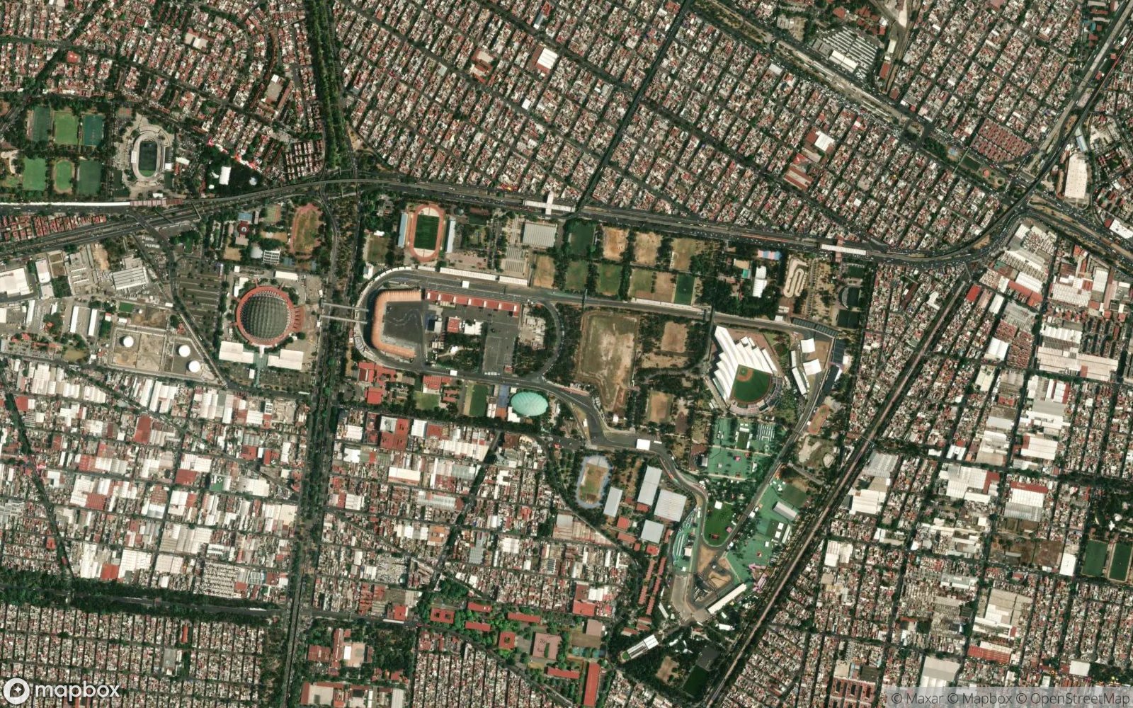
The Autódromo Hermanos Rodríguez is a 4.304 km (2.674 mi) motorsport race track in Mexico City, Mexico, named after the famous racing drivers Ricardo and Pedro Rodríguez. The circuit was built in 1959 at a public park in the Magdalena Mixhuca Sports City. It is renowned for its high elevation of over 2,200 meters (7,200 ft), which significantly affects aerodynamics and engine performance.
The thin air at this altitude means cars generate less downforce and cooling is a major challenge for the teams. This unique characteristic often leads to high top speeds despite the high-downforce wings used. The circuit's most distinctive feature is the Foro Sol (now Estadio GNP Seguros), a baseball stadium that the track passes through, creating an incredible atmosphere with thousands of fans overlooking the cars at slow speeds.
After a long absence, Formula One returned to the track in 2015. The modern layout retains the fast, flowing nature of the original "Esses" but features a modified final sector to improve safety. The long main straight provides one of the best overtaking opportunities on the calendar, often seeing dramatic moves into Turn 1.
Play Racing Circuits Quiz 📖 Read More 🗺️ Google Maps 📘 F1 Tracks Guide